DRBA FSO FLOAT ON THE SMITH RIVER
August 5, 2016
This event is free and open to the public.
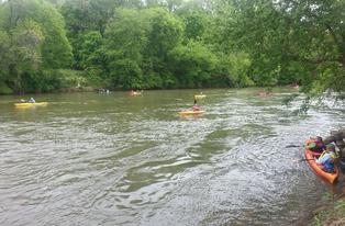
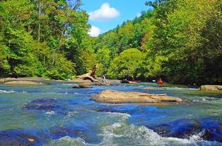
You are invited to join the Dan River Basin Association (DRBA) for its August 6 First Saturday Outing. DRBA will float 4.5 miles on the Smith River from Morgan Ford Bridge near Sandy Level in Henry County, Virginia to Eden, North Carolina, using private access to the river for both put-in and take-out. DRBA thanks the landowners for graciously giving permission to use their property.
On the same day, DRBA is supporting another event: the Dan River Boat Race in Madison, for which information is at www.danriverboatrace.org.
Participants in the outing will meet at 10:00 a.m. at the Morgan Ford Bridge, on Morgan Ford Road, Virginia Route 622 (GPS 36.559023,-79.746569) to unload boats and gear, sign waivers, and set the shuttle. For boat rentals and shuttle, contact Three Rivers Outfitters, 336-627-6215, www.3-r-o.com.
Coordinator for the trip is Lucas Conkle, expert kayaker and chair of DRBA Outings Task Force. The trip is rated as Class I, suitable for novice paddlers.
According to Conkle, “This seldom paddled stretch of river is an overlooked gem of our local rivers.”
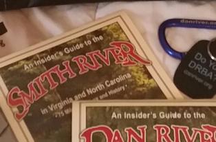
The tall stone towers that supported the original bridge at Morgan Ford are just downstream of the put-in. Shortly thereafter, paddlers will slip under the present-day bridge, the last remaining steel truss bridge spanning the Smith River. It was assembled from other structures in 1953—a perfect example of resource reuse. According to DRBA’s “An Insider’s Guide to the Smith River,” available at www.danriver.org, “The through-truss part was built in 1887, moved here from Pittsylvania County.” From Mecklenburg County came the low truss; the steel girders are from Salem; and the plate girders are from the Norfolk & Western railroad overpass in Vinton.
Conkle comments, “The relic piers of the original Morgan Ford Bridge and the steel trusses of the current bridge are just really cool and unique things to see.”
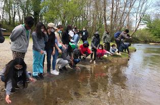
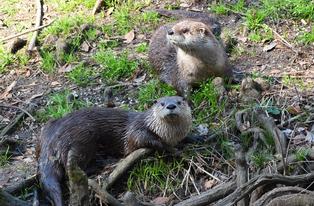
Wildlife and wildflowers are abundant on this section of the river, which crosses the state line about two miles below Morgan Ford Bridge. Here, Conkle notes, “On river right is the large rocky bluff of Devil's Den.”
About half a mile further downstream is a good example of a Native American fish weir. This vee-shaped rock structure in the river was used to funnel migrating fish into a basket or net as they returned toward the sea after spawning. Both Indians and early settlers used these fish weirs to capture large quantities of fish, providing food and an economic resource.
At one-mile intervals farther on are two bridges honoring prominent twentieth-century residents of Eden: the physician Dr. John B. Ray and Episcopal priest The Rev. William J. Gordon.
The private take-out is half a mile below the William J. Gordon Bridge, just upstream of the Spray Dam. This dam diverts water into the mile-long 1813 Barnett Canal, which generated power for over 150 years in what was one of the largest textile complexes in the piedmont region. The turbine at the foot of the canal provides hydroelectric power to this day.
Participants in the outing should supply boat, paddles, life jacket for each boater, water and lunch; dress in quick-drying fabric; and be prepared to get wet. All participants will be asked to sign a waiver.
DIRECTIONS: To reach Morgan Ford Bridge from US 58 in Virginia: At Axton, turn south onto County Road 610 (Axton Road). Drive 8 miles. Turn right onto County Road 622 (Morgan Ford Road). Drive 1.3 miles to the bridge. Cross the bridge and immediately turn right into an unpaved driveway.
From Eden, NC: Take NC 14/87(Van Buren Road) north toward Virginia. At a traffic light, turn right onto East Aiken Road. Immediately turn left onto Virginia Street. Drive 3 miles, entering Virginia (Virginia Street becomes Axton Road). Turn left onto County Road 622 (Morgan Ford Road). Drive 1.3 miles to the bridge. Cross the bridge and immediately turn right into an unpaved driveway.
Trip leader and contact: Lucas Conkle, conklel@alumni.greensboro.edu.