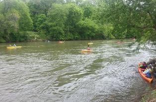
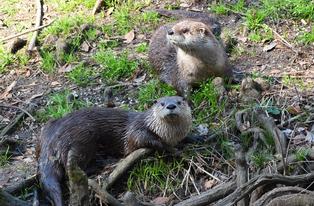
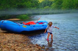
River Info
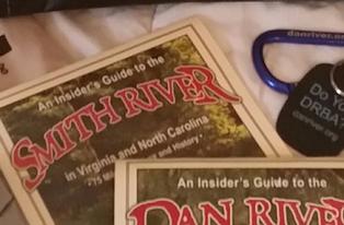
For "all things Dan River", download the free Adventures in the Dan River Basin by Forrest Altman (58-page pdf file.) Altman takes readers through every aspect of the basin's development, from the Triassic-era fossils of dinosaur forerunners through the cultures of Native Americans and early European settlers, and on to a comprehensive mile-by-mile guide to the basin's rivers today. He offers a thorough list of festivals, events, and other natural and heritage attractions, along with contact information. His book, The Dan River Book, Odyssey, Epic, Guide, and The Dan River Atlas, by William E. Trout, III, are available from the DRBA Store.
Another excellent source of information is Paddling Eastern North Carolina with Paul Ferguson. This expanded 2nd edition of the guide has added over 600 miles of an already extensive list for rivers, creeks, swamps, white water and flat water and includes trip descriptions and maps.
River Information
Time of travel in every section of the Dan and other rivers are directly related to river gage height and flow of water in the river. Times listed below will vary from trip to trip and should be used only as a suggested time of travel.
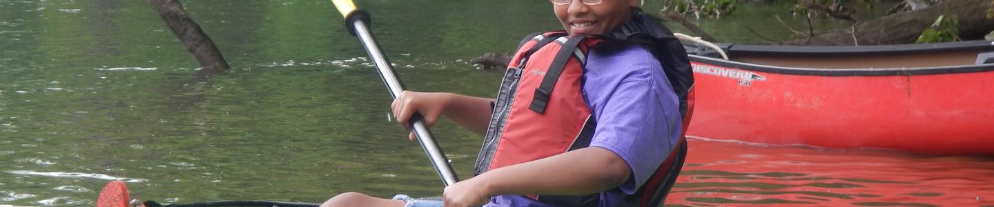
These general ratings of rapids and riffles in the Dan River Basin can be invaluable resources for planning your trip to the river.
Dan River, Stokes County, NC
- Location
- Distance
- Time
- Class
- Hart Access to Hanging Rock
- 12.4 miles
- 5-11 hours
- Class I & Class II
- Hanging Rock to Moratock Park
- 5.9 miles
- 2-5 hours
- Class I & Class II
Dan River, Rockingham County NC
- Location
- Distance
- Time
- Class
- Lindsay Bridge Road to 704 Bridge
- 2.5 miles
- 1-2 hours
- Class II
- 704 Bridge to Settles Bridge
- 8 miles
- 3-5 hours
- Class I
- Settles Bridge to Hamilton Street Landing
- 10 miles
- 4-6 hours
- Class I
- Hamilton Street to Eden Boat Landing
- 1.5 miles
- 1 hour
- Class I
- Eden Boat Landing to Danville
- 28 miles
- 14 hours
- Class I
Mayo River, Rockingham County, NC
- Location
- Distance
- Time
- Class
- Anglin Mill Bridge to South end of Mayo Beach
- 1.5 miles
- 1 hour
- Class II & Class III
- South end of Mayo Beach to Business 220 Bridge
- 8 miles
- 3-5 hours
- Class I
- Business 220 Bridge to Dan River
- 4 miles
- Not Recommended
- Class I & II
Smith River, Henry County, VA
- Location
- Distance
- Time
- Class
- Philpott Dam to Bassett Access
- 6.4 miles
- 3.5 hours
- Class I to Class III
- Bassett Canoe Access to Great Road Access
- 5.3 miles
- Class I to Class III
- Great Road Access to Fieldale Trail Access
- 5.3 miles
- 5.0 hours
- Class I to Class II
- Fieldale Trail Access to Doe Run
- 5.4 miles
- Class I to Class II
- South Martinsville to Smith River Sports Complex
- 5.3 miles
- 2.5 hours
- Class I to Class II
- Smith River Sports Complex to Marrowbone Creek
- 2.5 miles
- 4.0 hours
- Class I to Class II
- Marrowbone Creek to Mitchell Bridge
- 3.4 miles
- 6.0hours
- Class I to Class II
- Mitchell Bridge to Morgan Ford Bridge (No official canoe access at Morgan Ford)
- 7.3 miles
- Class I to Class II
- Morgan Ford to Spray Dam (private)
- 4.7 miles
- Class I to Class II
- Spray Dam to Island Ford Access
- 1.0 miles
- Class I to Class II
- Island Ford to the NC Wildlife Access on Dan River
- 2.1 miles
- Class I to Class II
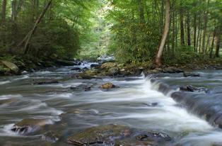
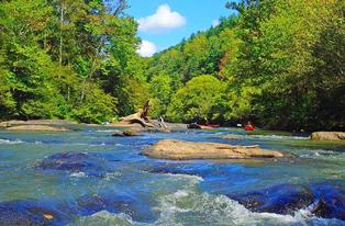
Rapids Ratings
The ratings of rapids and riffles is a subjective and sometimes touchy subject. Ratings vary from class I to class VI. Below is a general rating system. The Dan River Basin rapids generally fall between class I and III, depending on water flow. This is what makes the Dan River Basin such an enjoyable place for recreational and family outings.
- Class I-few riffles, maybe small waves, if any, few obstacles and very little maneuvering
- Class II-easy rapids with waves of 2 ft., wide channel with little maneuvering
- Class III-waves large enough to overturn canoe, narrow passages with increased maneuvering
- Class IV-large difficult waves, precise maneuvering
- Class V-very difficult, advanced maneuvering with constricted passageways
- Class VI-generally considered unrunnable
These class ratings are general and definitely have limitations. The best way to understand a rapid and learn about a river is to learn how to read the water, and then scout rapids on your own. The decision to paddle or portage is a personal decision that everyone who runs whitewater class I or class V should learn to make.