DRBA to Float Dan near Eden
May 5, 2018
6:00 AM - 12:00 PM
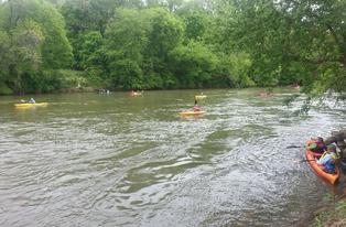
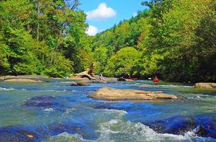
The Dan River Basin Association’s May 5 outing will be a 5.5-mile float on the Dan River from Whetstone Creek to Eden Wildlife Access. Meeting at 10:00 a.m. at the NC Wildlife Access in Eden, locally called the Boat Landing (36.4752, -79.7503), participants will paddle through several navigation sites, well-preserved nineteenth century river structures listed on the National Register of Historic Places.
The navigation structures provide easy passage through shallow areas, making this a Class I section, suitable for novice paddlers. Boats and gear may be rented from Three Rivers Outfitters, 336-627-6215, www.3-r-o.com. Coordinator for the outing will be DRBA board member Mark Bishopric, avid paddler and outfitter.
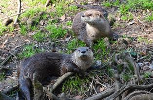
Bishopric comments, "After accessing the river using Whetstone creek, paddlers will have the opportunity to navigate several batteau sluices as we journey towards Leaksville Landing, on a stretch of river that was used for batteau traffic starting around 1800. Hopefully we can watch nesting blue herons at Matrimony Creek."
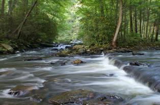
The navigation structures in the Dan, built in the 1820s and expanded as late as the 1880s, include sluices, landings, and wing dams that made the river usable by flat-bottomed batteaux, the long, narrow workhorses of nineteenth century river commerce in the region.
According to North Carolina historian Lindley Butler, “The structures channel the water through rapids and ledges that would have blocked the batteaux, each of which carried several tons of goods. Present-day recreational users enjoy the effects of these structures, which have been self-maintaining for over 130 years. The improvements enable us to float the Dan throughout Rockingham County even in times of extreme drought.”
In this section, boaters will pass through Galloway’s Lower Ford Sluice and Sneed Strong’s Fish Dam Sluice. Two miles into the trip, on river left, was the Grief Wade Plantation where coal was mined during the Civil War and shipped by batteau to heat military prisons in Danville.
For four miles of the trip from nearly the beginning, participants will float past a large parcel on river right being developed by Piedmont Land Conservancy and the North Carolina Wildlife Commission for public use, including a riverside trail. The project will add significantly to Rockingham County’s recreational amenities.
Just past the confluence of Buffalo Island Creek on river left, boaters will pass under the Harrington Highway Bridge. Nearby on river left, one may see a fine stand of river cane, the only bamboo native to the United States. It was common on the banks when William Byrd surveyed the “Dividing Line” in 1728, but now is gradually disappearing throughout much of the river’s length.
Also entering from river left is Matrimony Creek, so named by Byrd because, like his marriage, it was “exceedingly noisy and impetuous.” After a lunch break, boaters will reach
Leaksville Landing, the only known batteau port remaining in the nation. Leaksville Landing Access is just downstream.
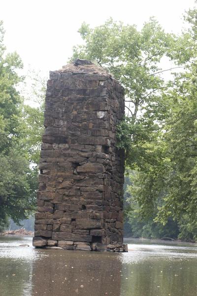
After drifting past Johnston’s Landing, boaters will pass the site of the former Leaksville Covered Bridge, where a massive stone pier from the 1852 span survives, along with a 150-foot-long sluice wall on river right.
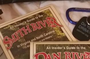
One of the last points of interest on the trip will be the confluence of the Smith River, which enters the Dan from river left. According to The Dan River Book by Forrest Altman, the North Fork of the Smith and the East Fork of the Dan rise on opposite sides of Mountain View Road on Belcher Mountain in Patrick County, Virginia, within sight of the Blue Ridge Parkway.
More information may be found on Maps 47-50 of An Insider’s Guide to the Dan River. Both the Guide and Altman’s book are available at www.danriver.org.
Participants in the outing are asked to bring boat and paddles, life jacket for each boater, lunch and water, to dress in layers of artificial (quick-drying) fabric and to sign a waiver.
To reach Eden Wildlife Access from the north, travel south on NC 14 through the city of Eden. After crossing the Dan River, turn right at the traffic signal onto Harrington Highway. Take the first right, Bethlehem Church Road, turning right again at the Wildlife Access.
From the south, turn left off NC 14 onto Harrington Highway at the traffic signal just south of the Dan River. Turn right onto Bethlehem Church Road, then right to the Wildlife Access.
From the west, take NC 770 or NC 135 toward Eden. Turn right onto Harrington Highway and continue to Bethlehem Church Road. Turn left, and then right to the Wildlife Access.
From the northeast take US 58 to Danville’s western city limit, turning left on Road 863 to Berryhill Community, where 863 becomes NC 770 West. Follow NC 770 West into Eden to NC 14. Turn left onto NC 14 and travel south through Eden, cross the Dan River and turn right at the traffic signal onto Harrington Highway. Take the first right, Bethlehem Church Road, turning right again at the Wildlife Access.
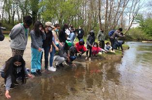
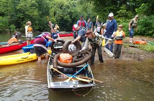
Outings and meetings of the Dan River Basin Association are open to the public without charge.